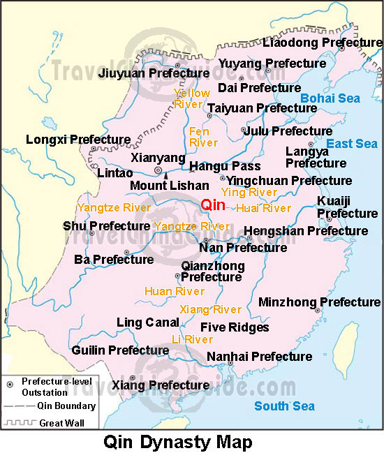
This is a map of China during the Qin Dynasty from 221 B.C to 207 B.C. The dashed line represents the Qin boundary. China's current boundaries have changed very much since this time period!
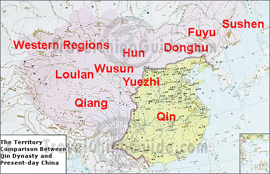
The map shown above shows the Qin dynasty in comparison to the present day map of China. The map of China during the Qin dynasty has grown tremendously as you can see in the picture above. The area shaded in yellow is the Qin dynasty, the pink shaded area is now the present day map including the Qin dynasty.
No comments:
Post a Comment